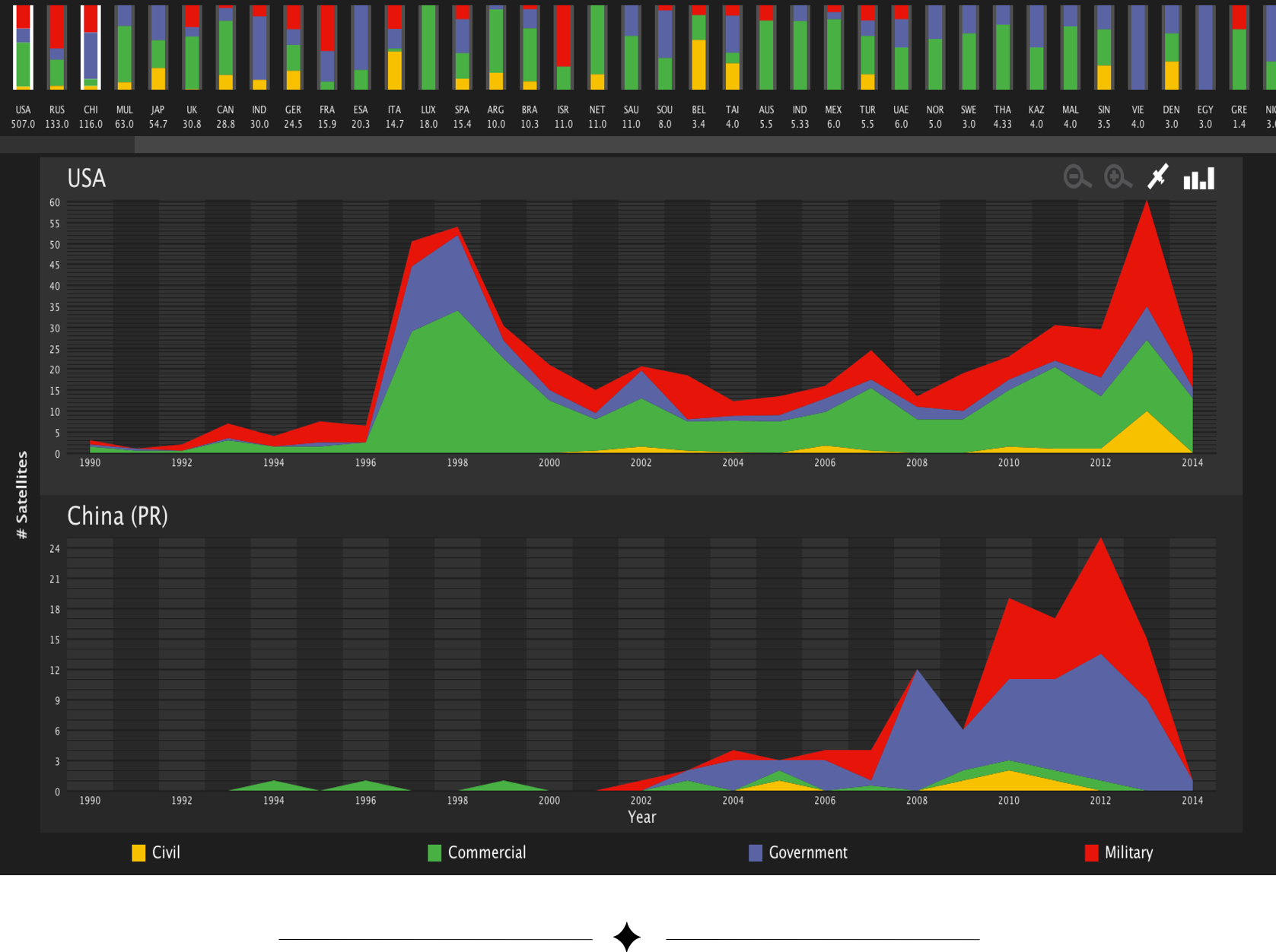
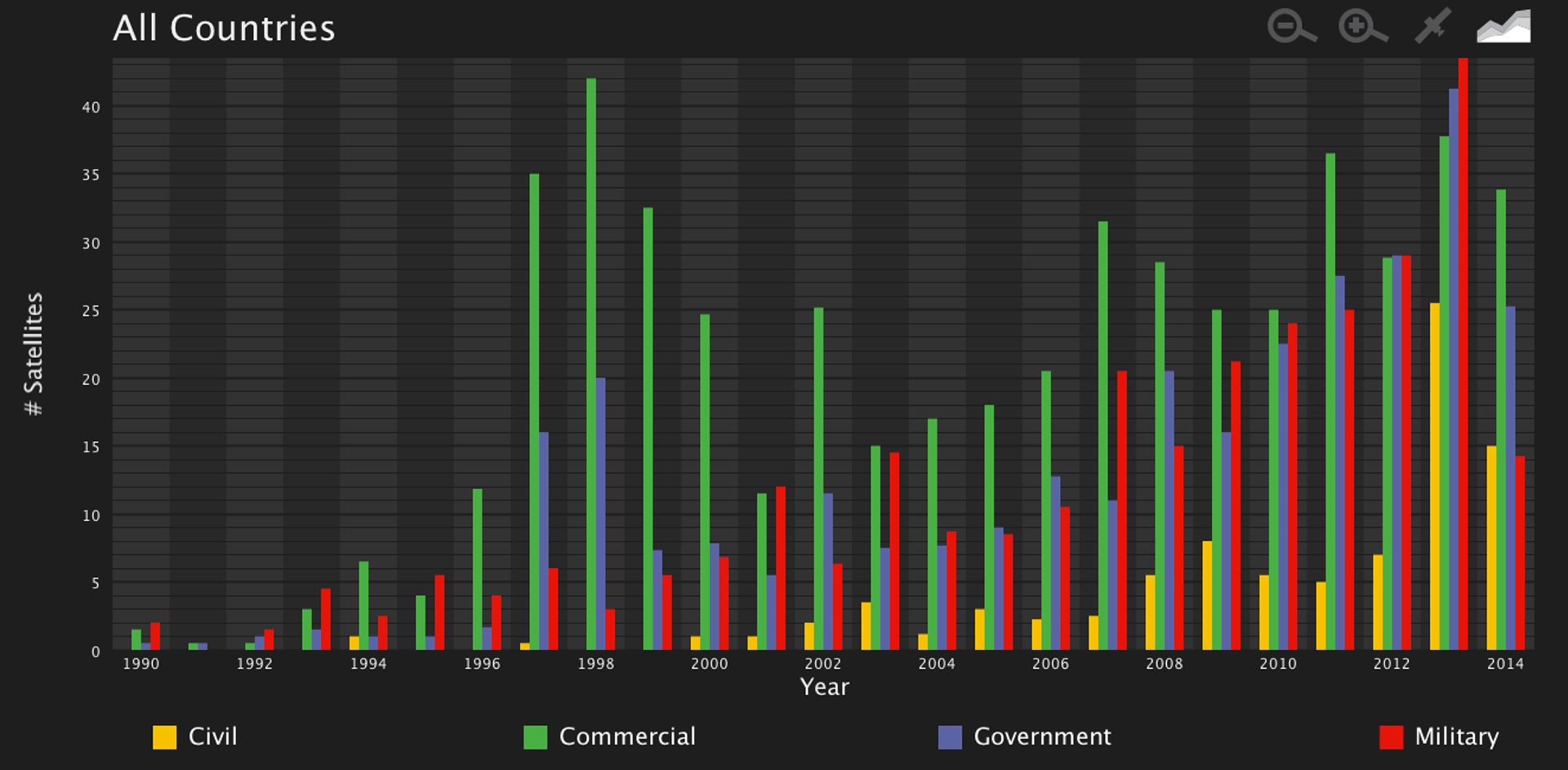
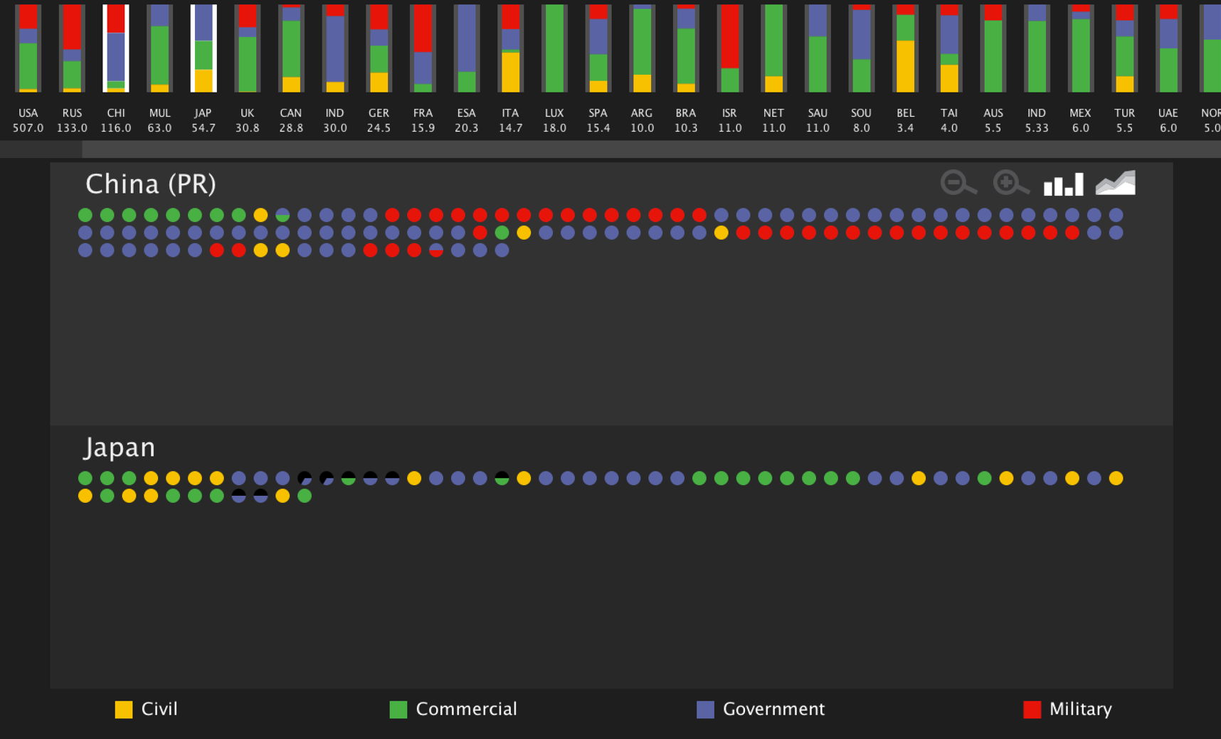
The sky is full of artificial satellites orbiting our planet: potentially powerful technologies that are used for many different purposes, such as positioning and navigation, scientific research, and military reconnaissance, just to name a few. There are currently more than 1200 active satellites orbiting the planet, launched by more than 40 different countries, and controlled by different types of users, such as governments, militaries, corporations, and civilian groups. With all of these countries and groups controlling such powerful devices, a problem arises: how can we tell which countries are utilizing this technology, and for what purposes are they using them?
This visualization was completed as part of CPSC 683: Information Visualization Theory and Practice. The aim of this project was to visualize a set of data describing all active satellites: Which countries own them and what are their purposes?